CHAPTER SEVEN
R
ight from the very beginning of our work on the book, we had the idea of making a beautiful map. So for almost a year we looked for various options of what kind of map we could have in the book.
The collection of references for the map from printed publications (Dzima) and old maps (Slava):

Atlas wysp odległych — Schalansky Judith (Empik)

Atlas wysp odległych — Schalansky Judith (Empik)

Atlas wysp odległych — Schalansky Judith (Empik)

1665, From Slava’s archives


1797


Map of the Nyoman River Basin 1902 года

1907

1910

1933

A pre-war Polish topographic map of central Belarus 1933

A Luftwaffe flight map from 1941. European part of the USSR.
Ten kilometres.

1943

A British military map of Europe during the Second World War 1943

A British military map of Europe during the Second World War 1943
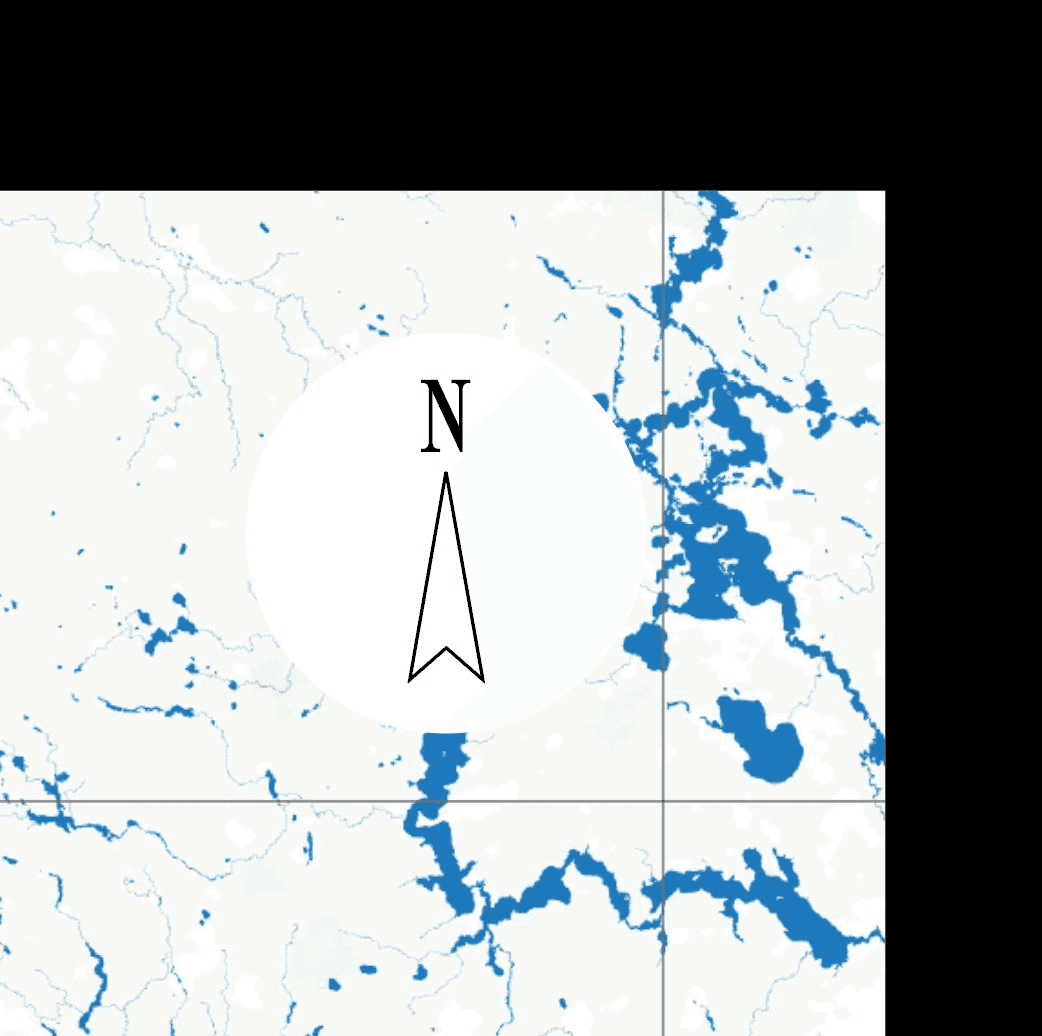
While studying these references, we decided that a book about nature should show natural places of interest on the map: rivers, lakes, forests. Meaning that it should not focus on settlements.
At first we decided that we wanted to make one general map for the whole book and separate, larger maps for each section of the book.
Here Slava is making a map for the book using Mapbox. He is removing towns and roads, leaving only the nature:


Trying to see if there is any relief in Belarus on the map
Inspired by the beautiful images of the islands, I asked Slava to add the relief to the map.


Dzima's message to an acquaintance who drew maps

Slava found names of settlements in Belarusian

A reference of a beautiful map illustration
Slava even made a beautiful map. That is, he took some raw data from somewhere and tried to render it onto a map according to his own rules. Slava tried to explain it all to me, but it was way too complicated.


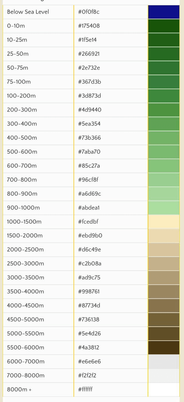


The relief

The blended relief

The contour of Belarus on the relief

River basins

Reference maps

Colour references for the map (Source)

Colour references for the map (Source)

Colour references for the map (Source)

Lake Narach

Lake Narach

The Jelnia bog, false color

The Braslav lakes

Lake Narach in winter

Спроба выкарыстаць DALL-E і Midjourney для стварэння мапы

Midjouney

Midjouney

Midjouney + Photoshop
An idea to make the map from different layers (Slava):


An idea to add road routes to the maps (partially developed but not used)

An example of a route

The rivers of Belarus in words on a map (Slava)

Максімальныя хуткасці на дарогах (Слава)

Dzima: "I see a unicorn.”

Villages

Villages

Settlements with the name “Navasselki”
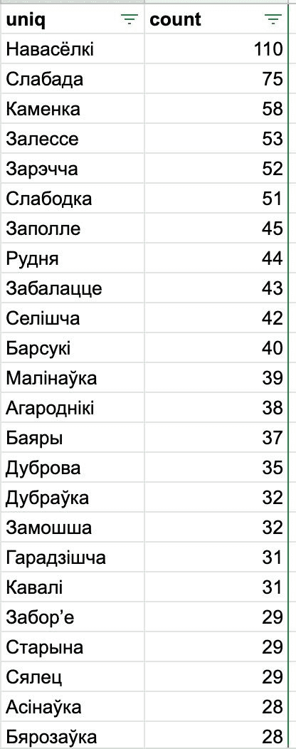
The most popular settlement names in Belarus and their quantity

Photos from the book on a map

Settlements near which the photos were taken
At the time, Slava made a million different maps. In the process of searching for the right one, there was an idea to display settlements in the shape of Belarus. This is how another project — Veska — began. “Veska” means village in Belarusian.


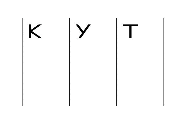
After we overlaid a coordinate grid onto the map, numbered the modules and then added “KUT” at the beginning, the idea for the future logo of the project was born.


Ikuta Sans

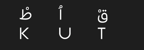
"KUT," written in Belarusian Arabic (above) and Latin (below)
We then had an idea to display all the photos of the book connected to points on a map using threads, like detectives do in films, but it turned out to be too confusing.


Another meeting to develop the map

The concept of a pink map (Slava), developed partially.
Was not used

The concept of a pink map (Slava)

The concept of a pink map (Slava)

The concept of a pink map (Slava)

An idea to use a light pollution map (Slava, not used)

Light pollution in Minsk


An interesting side note about Belarus. A map is a projection of a sphere (i.e. the Earth) onto a flat surface. All maps are inaccurate as this projection causes distortions. The most popular project is the Mercator projection. We see it, for example, on Google Maps. But there are many other projections. The contour of any country will have a different size and shape depending on the projection used. The contour of Belarus that we are all familiar with with built on the basis of the Mercator projection. I decided to see how Belarus would look using other projections. However, it turned out that, due to the peculiarities of the position of Belarus, the contour stays almost the same.

Dzima explores how the shape of the contour of Belarus looks like in different projections of the sphere onto a flat plane

Developing the style of the map in Mapbox

Developing the style of the map in Mapbox


Book contents

Book contents


The contents in the pilot version of the book